Day 5 - Ludlow to Wheathill
In a hugely frustrating moment of stupidity I managed to delete all the photos I took today but have managed to recover most of them. Sadly the best bit (the climb up Titterstone Clee Hill) is totally gone, along with a few other bits I wanted to share... never mind!
My dad's journal again served as my guide:
I started off with a look around the market, which as it was market day had filled the main square with a throng of people and colourful stalls. Sadly it's mostly another market that's turned from selling genuine locally produced foods to flogging generic mass-produced arts and crafts to tourists (how many bloody coasters does anyone need?) though there are a few proper produce stalls like the fruiterer, flower-seller and the butcher with local pork pies etc.
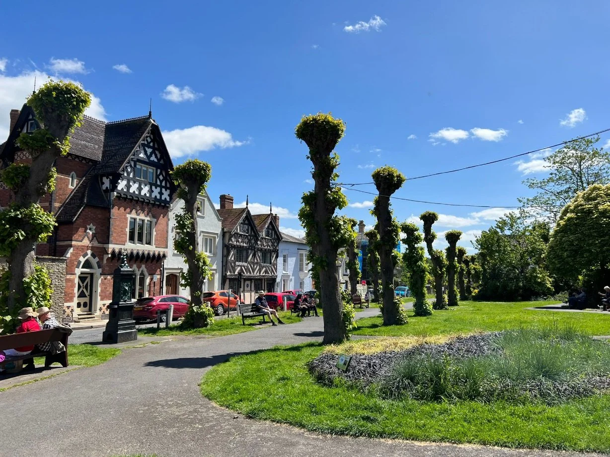
Had a look at Ludlow castle but decided that if there wasn't much of a ruined castle left to see 50 years ago there wouldn't be much left now either, so I didn't pay to go outside, That said the gardens at the front gate facing the market square are particularly pleasant, and the way the castle sits by the town lends it a good deal of its charm.
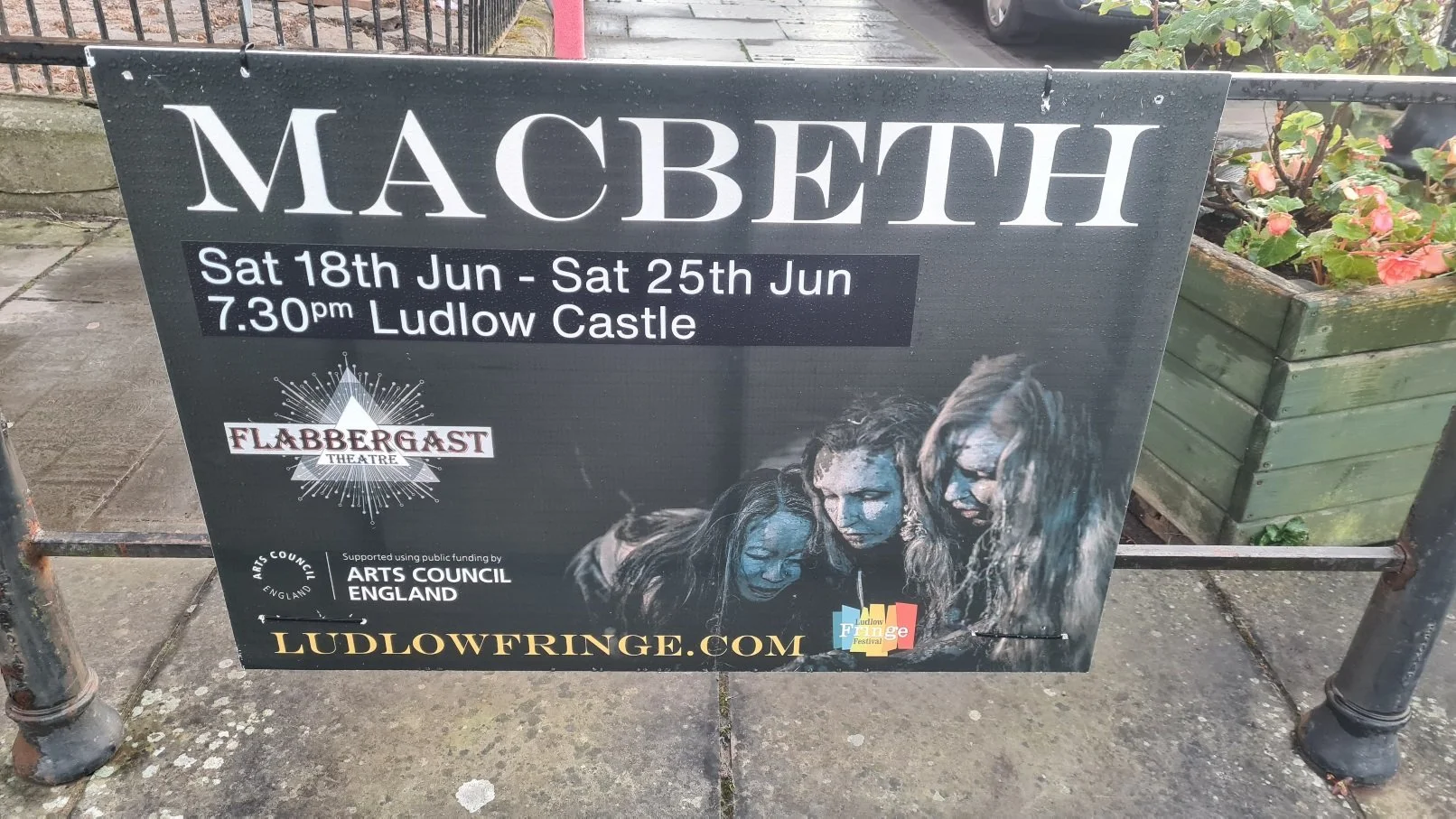
One thing that was nice to see was that they are still putting on Shakespear plays in the castke grounds - I saw a poster for Macbeth in a few weeks time.
Then went to the tiny museum which turned out to be quite good. The current owner has got rid of the torture instruments that my dad saw although an old policeman's baton there looked like it had probably been used to club a few crimos with. There was still the victoriana and posters, and quite a bit more. In fact they'd managed to pack into two small rooms a history of Ludlow so thorough it went from modern times back through medieval, Roman and neolithic times right back to the geology of the rocks themselves.
Next port of call was the church, which my dad's description does fair justice to. With the help of the guides we managed to locate the misericord carving of the pub landlady being thrown into the fires of Hades for underpouring her ales!
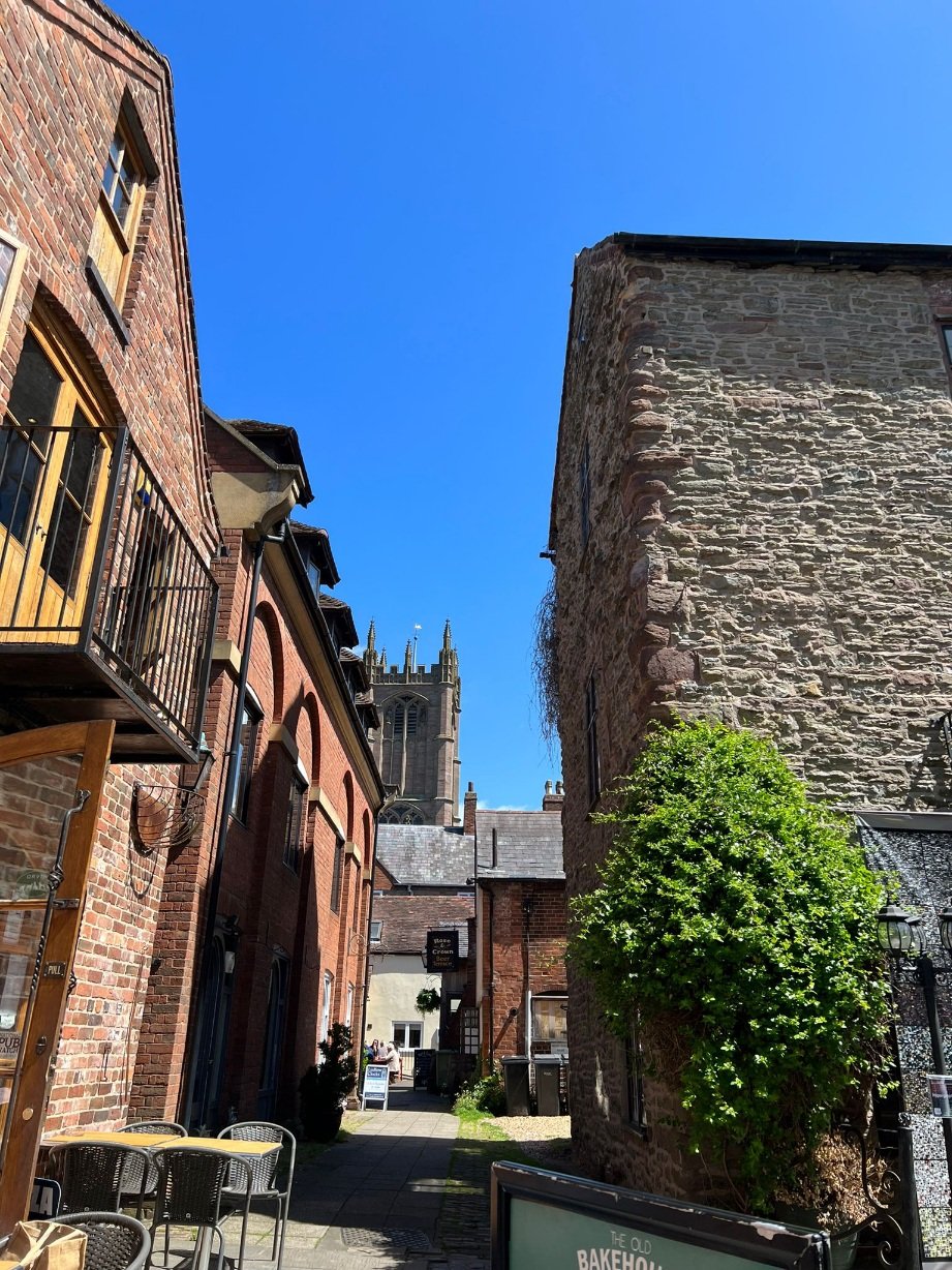
Hankering for something a little exotic for lunch I ended up in a sourdough pizzeria in a courtyard just off the main market square where I had a trout pizza. Yes you read that correctly. In a moment of madness I went for the strangest item on the menu which had smoked trout with samphire, capers and preserved lemon on it. I had an inkling that it might actually work and indeed it did. Not sure what my dad would've made of that! The drink I ordered with it was another lifetime first - spiced tomato juice (aka Virgin Mary) but made with freshly juiced Hereford tomatoes. It was the tastiest Mary I've ever had, though I foregoed the vodka, not wanting alcohol before a long day's walking.
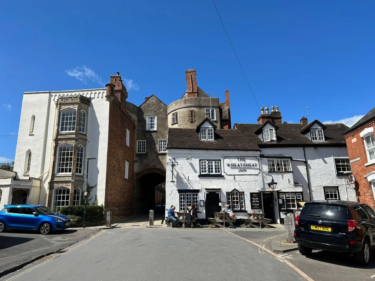
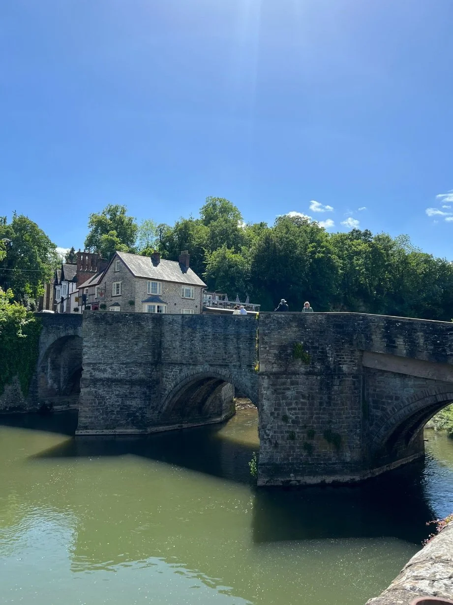
On the way out of the town I walked through the medieval gates and bridge to to the former Youth Hostel at Ludford Lodge, sadly now closed down, and peered over the gate. A man was mowing the lawn at the far end of the garden and I tried to speak to him but he couldn't hear me so I gave up and took a few pics of the house from across the river. It looked like it must’ve been a very substantial place though. On the last pic below it’s the red roofed building to the left of the bridge.
Time was ticking and I still had a lot of walking to do so I set off following dad's route:
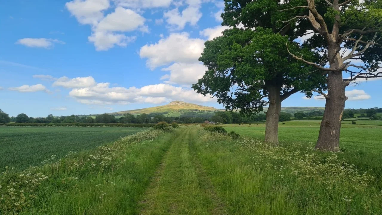
The first part involved walking on the verge of a busy road but when we got out into the open countryside it became very pretty. The section on the railway line was particularly scenic. This shot looking down the line with Titterstone Clee Hill in the distance is the only picture I managed to save of this part of the day.
Suffice to say Bitterley still has no pub or shop, though it is pretty. I stopped and talked to a teacher at the school who is going to ask around to see if anyone remembers Mr Price the school bus driver, so watch this space.
Trying to track my dad's route was difficult here as I couldn't find mention of a Henley Cross on any map or any evidence of its existence online anywhere. I did however find a farm caked Henleyhill not too far away and nearby a place where two lanes crossed, albeit at a dog's leg. As it was in generally the right direction, I walked there, and from there made my way through more lanes to foot of Titterstone Clee Hill. My arrival prompted the ceaseless barking of a particularly annoying dog in a nearby garden whose shrill yelping I could still hear even when I'd walked for 10 minutes or more away up the hill.
Climbing Titterstone was exactly as described, minus the Goodyear airship or the company of two girls from Cannock. The views were amazing but to be fair views from a hilltop are never the same in a photo, so you'll have to climb it yourself!
The scramble down the hill was tough going as it we getting late so I used the gps tracker on my OS map app to ignore the pathway and follow a straight course to the village below over scree, scrub and sheep covered slopes. At Cleeton Court Farm, I spoke to a lady who was tending to a particularly handsome chestnut coloured stallion, and a man whose mother turned out to be the person who sold my dad the eggs all those years ago. She still lives in the same farmhouse though is quite old now.
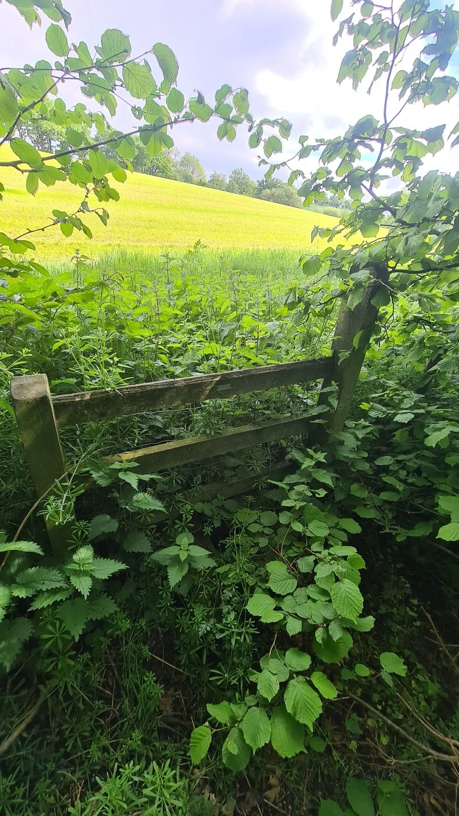
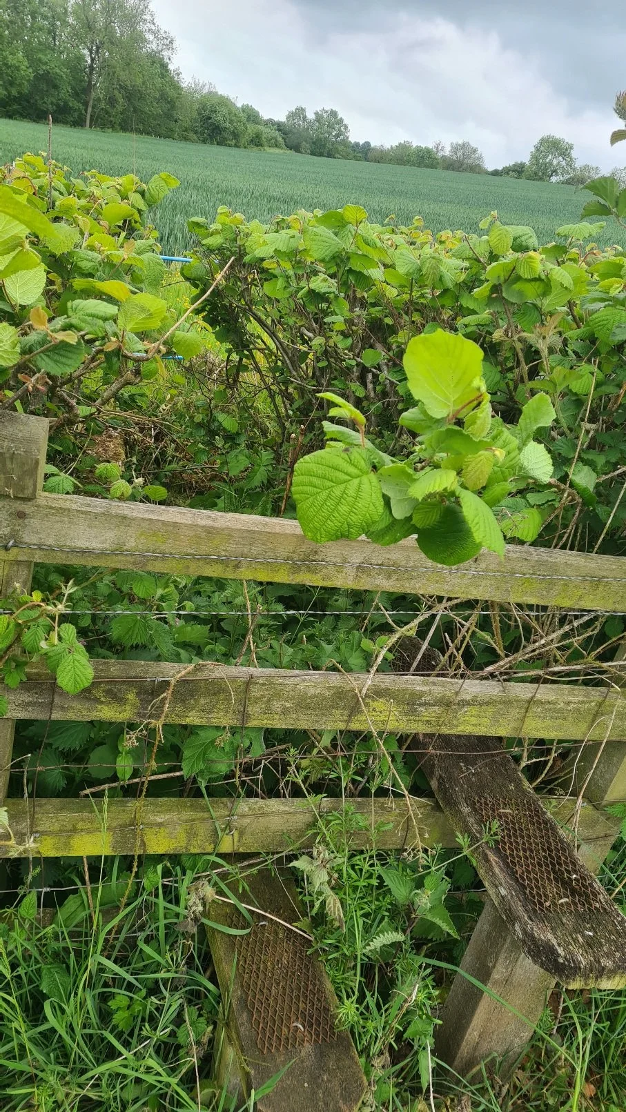
Another thing that hasn't changed in the past half century is the quality of the footpaths in this particular corner of the country. The paths on the map were very hard to find. At one point I saw a wooden footpath sign leading straight through the middle of a 6-foot tall, very thick hedgerow, the gap that must have once existed though it having completely grown over to the point of sealing off the path entirely. In other places there were no signs of a path existing whatsoever and I had to use the map to decide which places to cross the fences, fields and hedges that blocked the way. Later that evening, the lady who lives at the house I stayed in told me that the landowner just destroyed all the stiles etc to put people off crossing his land. I think that's shoddy behaviour... the crushed grasses along the paths show that it doesn't work anyway and people obviously still use them but some around there are very hard to navigate indeed. They show up on digital maps as routes as well as the printed OS maps so more and more people will continue to want to use them and using the roads around here often means walking much longer distances to get to the same places. Here are some pics that survived of impossible footpaths:
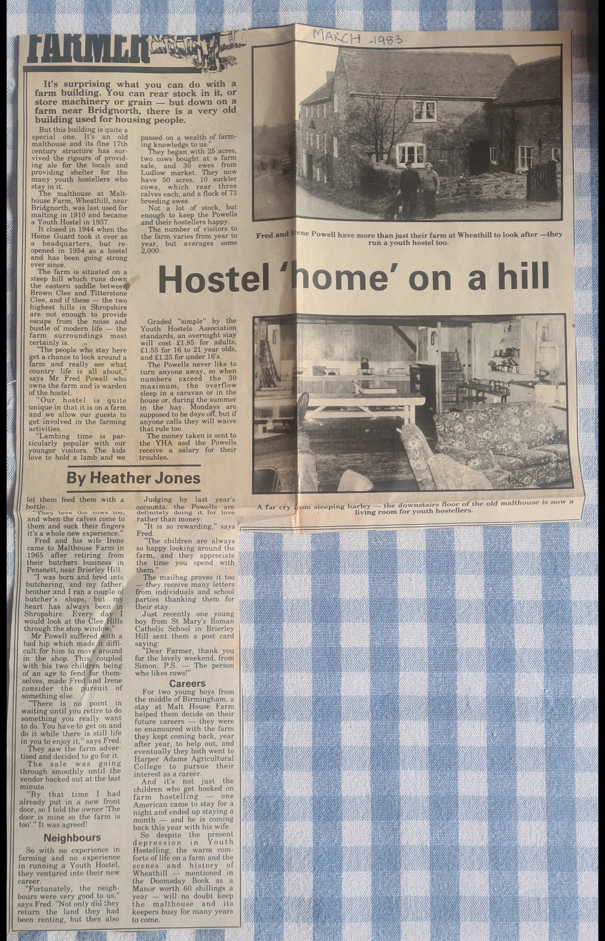
I reached Wheathill found Malt House Farm, where the former hostel was situated. It still looks much the same outside although the three sides of the wooden YHA triangle sign have been re-purposed to make a nameboard reading "Malt House Farm" with one word on each board. Again another sad case of a lost hostel. The owners couldn't afford to modernise it when YHA insisted all their hostels had to have all the modern amenities now expected at hotels. In my dad's day you got a bed and food. Anything else like hot showers or electricity was a luxury, and even considered too frivolous to be in keeping with the ethos of hostelling.
My accommodation was in a cabin at the bottom of somebody's garden nearby that I'd found on Airbnb. Choices in this part of the world were very limited, and it took me ages to find anywhere around Wheathill at all. It is a tiny place after all!
The lady who owned it was very friendly and came out with her dogs to say hello. She had looked out some old articles about the Wheathill YHA which included pics of the interior that give an idea of what it was like there. Sadly the place shut down 3 years after the happy hostel home article was written.
After dropping off my things I set out for The Boyne Arms at Burwarten, the one of the closest Hostelries where I had a healthy salad balanced out by a less healthy plate of chips and a pot of peppercorn sauce to dip them in. I also finally got to try the Ludlow ale which was pretty good, but I was so exhausted after the day that I didn't hang around after eating but went straight back to bed


